Water Resources Planning Institute (WRPI) has investigated the demand for data of better high resolution two-dimensional (2D) hydraulic modeling and proposes a data set named “Hydrological Topography Data Set” (HTD for short) for this purpose. Derived from the airborne lidar point cloud, the HTD comprises three parts:
- High Resolution Hydraulic Three-Dimensional Features: high resolution three-dimensional vector data that preserves the locations and elevations of topography breaklines.
- Hydraulic Digital Elevation Model (HyDEM): high resolution (1 × 1 m) DEM enhanced by the terrain breaklines to preserve the landscape characteristics.
- Hydraulic Digital Surface Model (HyDSM): high resolution (1 × 1 m) DSM conditioned by removing the height of vegetation and temporary objects.
With HTD, hydraulic features such as drainages with 10 m of width can be identified and properly set up in numerical models, thus can help to simulate and assess the flood in the urban area more in detail (Figure 1 and Figure 2). Through case studies, we demonstrate how HTD can affect hydraulic modeling results.
The results show that HTD can help modelers to construct proper mesh (or computational grids) for 2D hydraulic modeling, and preserve topography characteristics (i.e., shape and elevation), which improves the modeling results in terms of spatial resolution and physical rationality, while still keeping the computation efficient.

Figure 1. Comparison of the digital elevation model (DEM) and hydraulic digital elevation model (HyDEM) modeling results—large scale.
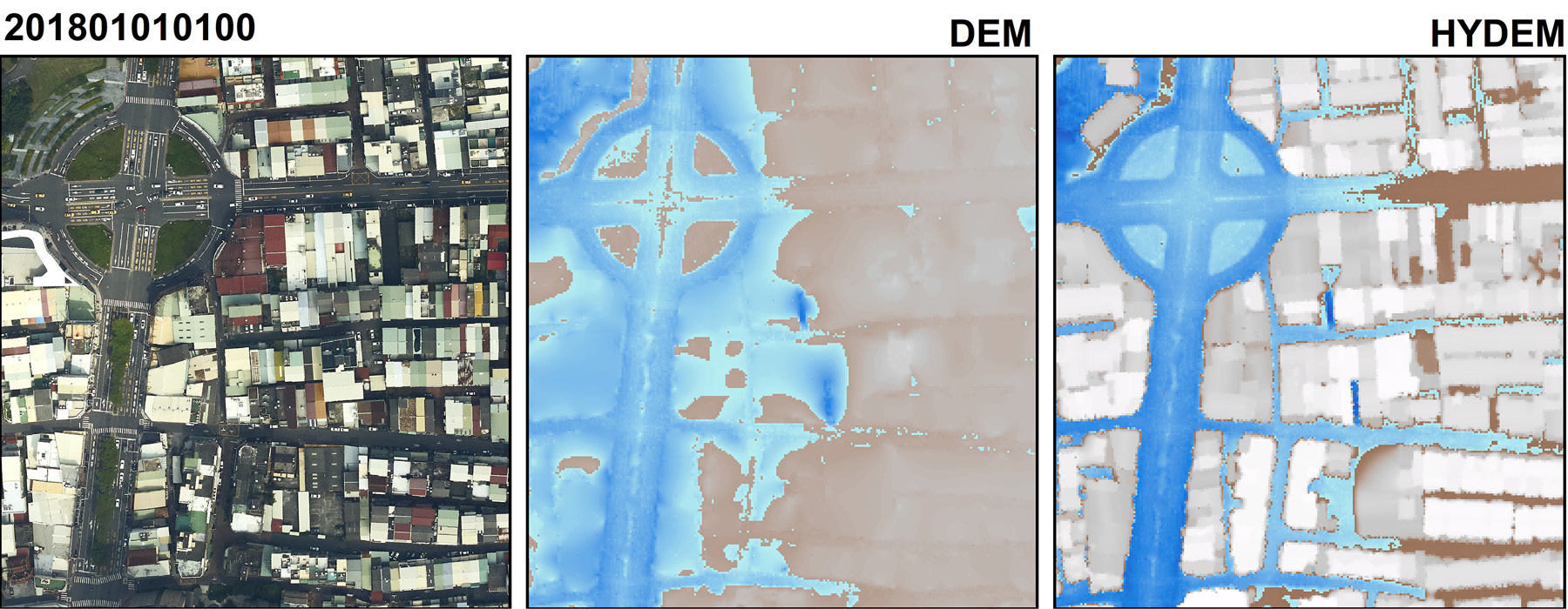
Figure 2. Comparison of the digital elevation model (DEM) and hydraulic digital elevation model (HyDEM) modeling results—small scale.