After outlying islands general sea dikes were built few decades ago, The coastal environments might not be the same as its construction duration. Since the ocean/atmospheric climate information for the decision of design condition becomes rich from the successive observations, it is necessary to revise the safeties of sea dikes under the current circumstance, and promote suggestions for future planning of coastal disaster preventions.
To review the design tide level and wave height at each coastal zone, this project numerically simulates the wave conditions around 5 outlying islands during the typhoon events between 1980 and 2018 and verified(shown in Figure 1, Lanyu station tide level and wave hight were verified in MATMO typhoon event), and design wave heights were chosen via return period analyses. The numerical simulations include an ocean scale simulation and nearshore scale simulation at each coastal zone. The wave refractions, diffractions, breaking, shoaling, and white capping effects were included. After then, the wave runup and overtopping were calculated in accordance to the simulated wave height in front of sea dikes(shown in Figure 2, the distribution of significant wave height near northern of Nangan, Matsu). Besides the engineering strategy, non-engineering strategy was recommended for protection from unpredictable extreme event, such as the actions of precautions or evacuations, and the limited land use management behind the sea dike.
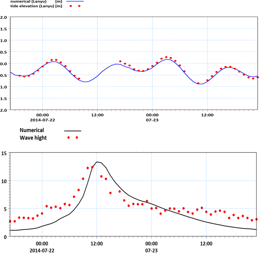 Figure.1 Verification of Lanyu tide level and wave hight

Figure.2 The distribution of significant wave height near northern of Nangan, Matsu