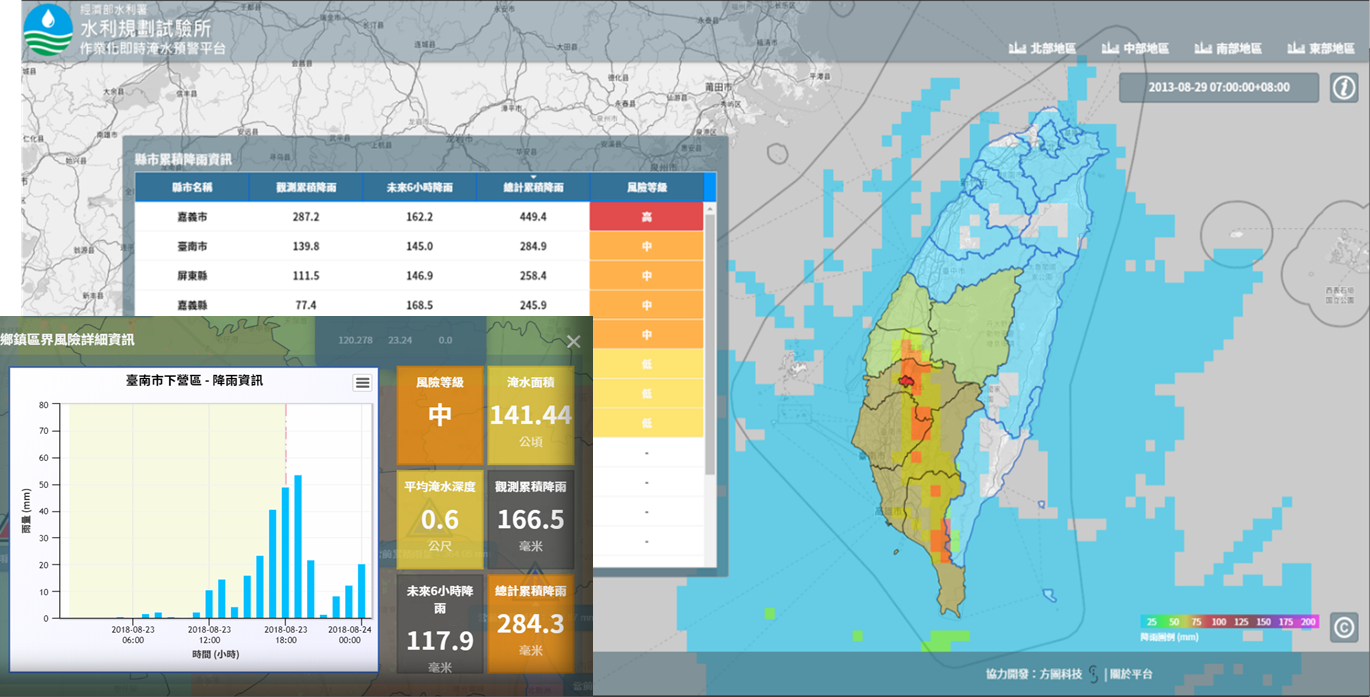
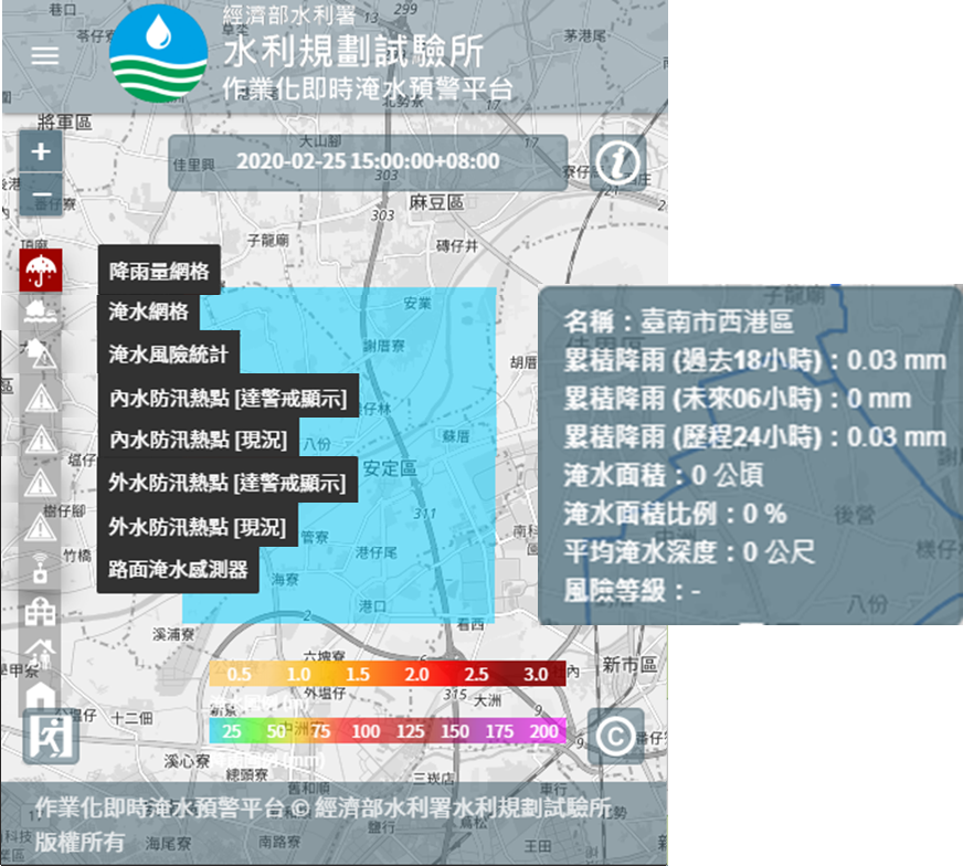
Taiwan is often invaded by typhoons and extreme rainfall events, which frequently lead to serious flooding disasters. To mitigate the damages and consequently the losses, it is critical to monitor the potential flooding conditions in (near) real time. The Water Resources Planning Institute (WRAP) works closely with National Taipei University of Technology (Taipei Tech) to co-develop a flood forecasting system. Based upon this system, a web-based platform has been developed, which will provide real-time flood warnings to 19 municipalities and counties over entire Taiwan in 2021. This system incorporates CWB’s (Central Weather Bureau) real-time rainfall observations and forecasts to provide a 6-hour lead-time flood forecasting and flood analytics with a 3-hour update cycle. This would enable the emergency officers and the relevant personnel to getting hold of timely information about the flood extents and potential damages at flooding hotspots. With this information, the preparation and distribution of resources prior to and during flooding events can be optimized, and consequently the damages can be effectively mitigated.

real time flood forecasting system web GUI
 Real time flood forecasting system Web GUI and map layers
An accurate calculation of flood extents is time consuming and requires huge computing resources. To reach the operational goal of providing accurate and reliable flood forecasts with 6-hour lead time and 3-hour update cycle, the development team takes advantage of the power of parallel computing. The forecast task is decomposed into a large number of sub-tasks, and an innovative scheduling strategy is employed to largely reduce the computational time. During the development period, this setup has been extensively tested using long-term design rainfall. This enables resembling various real-world scenarios, which helps identify errors that may potentially occur during operational context and ensure the stable and smooth operation after formal launch of the system.
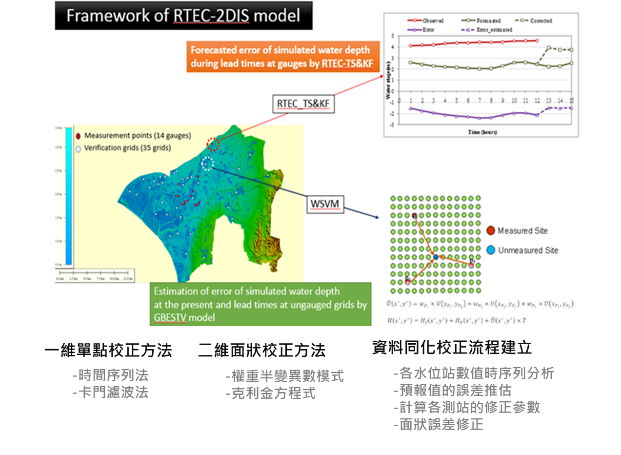
In addition to the system development, it is critical to take into account hydrological, meteorological and local hydraulic uncertainty that may affect the quality of flood forecasting. To address this issue, the development team is currently developing various innovative data assimilation algorithms. These algorithms will be used to cross compare and to assimilate the observations from the IoT based flood sensors with the flood forecasting results. This would effectively reduce the forecast errors, such that the forecast result can better represent the reality.
 Real-Time error correction model use 2D model and the IoT based flood Sensors method