-
Coastal Protection Plan
Hydraulic authority is the competent authorities for objectives of four disasters (coastal erosion, flooding, storm surge flooding and land subsidence). Implementation of coastal protection plan is divided into three main sections:
- Rolling review of “Reference manual of integrated coastal protection planning and coastal protection plan elaboration preparation (draft)”.
- Compile “report format of coastal protection plan”.
- Education training and consultant service of “Integrated coastal protection planning and coastal protection plan”.
-
The Study of Compensation Measures for Coastal Development Affecting The Protective Facility
Constructing defenses to against coastal flooding began at 1960s in Taiwan. With increasingly protection work, the life and property of coastal residents were fairly protected, which indirectly contributed to the prosperity in coastal regions. Subsequently, pitfalls due to large scale coastal exploitation, for example, coast erosion, land subsidence, and urbanization lead increasingly coastal hazard potential. This study focused on the effect of coastal erosion around or nearby coastal defense structures induced by the developments of industrial, commercial, and fishery harbors. Those construction projects were found to disturbed the continuity of littoral sediment transport and lead to the retreat of the shoreline on the downstream area. The intruding marine energy increased with the eroded amount within the continental shelf that causes the protection defenses damage or degradation.
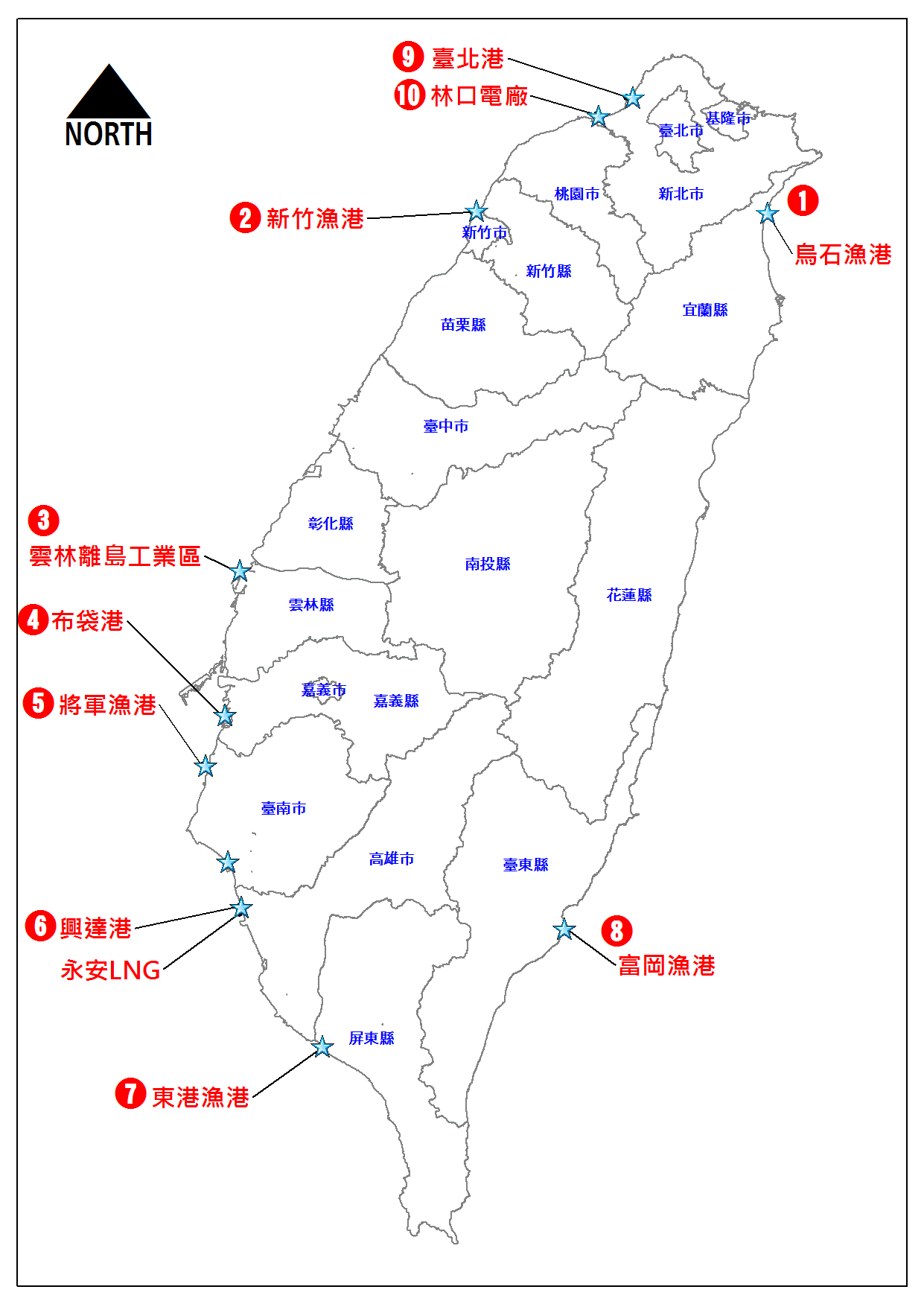
There are 10 places (Fig.1) selected to analysis the coastal erosion according to the behavior of coastal zoom development. After comprehensively analyzing-the results of the case analysis and the recommendations of various experts, scholars, and related institutions, a set of principles for evaluating the extent and scope of the impact on the surrounding coastal terrain after coastal development will be developed.

Figure.1 10 places of coastal erosion according to the behavior of coastal zoom development in Taiwan are selected to analysis.
-
Basic Database for Coastal Protection
This project aimed to rebuilt and refine the basic database for coast protection constructed by each river bureau in Taiwan. The basic database for coast protection has collected lots of kinds of sea property data, including wave, tide, current, drift sand, coastal topography, and water depth, that is for the purpose to improve the efficiency of the standard procedures of “The study of field investigation and basic database build” and foundation of “coastal erosion, flooding, storm surge flooding and land subsidence”.
Task items and content:
- Data base system regular maintenance and backup.
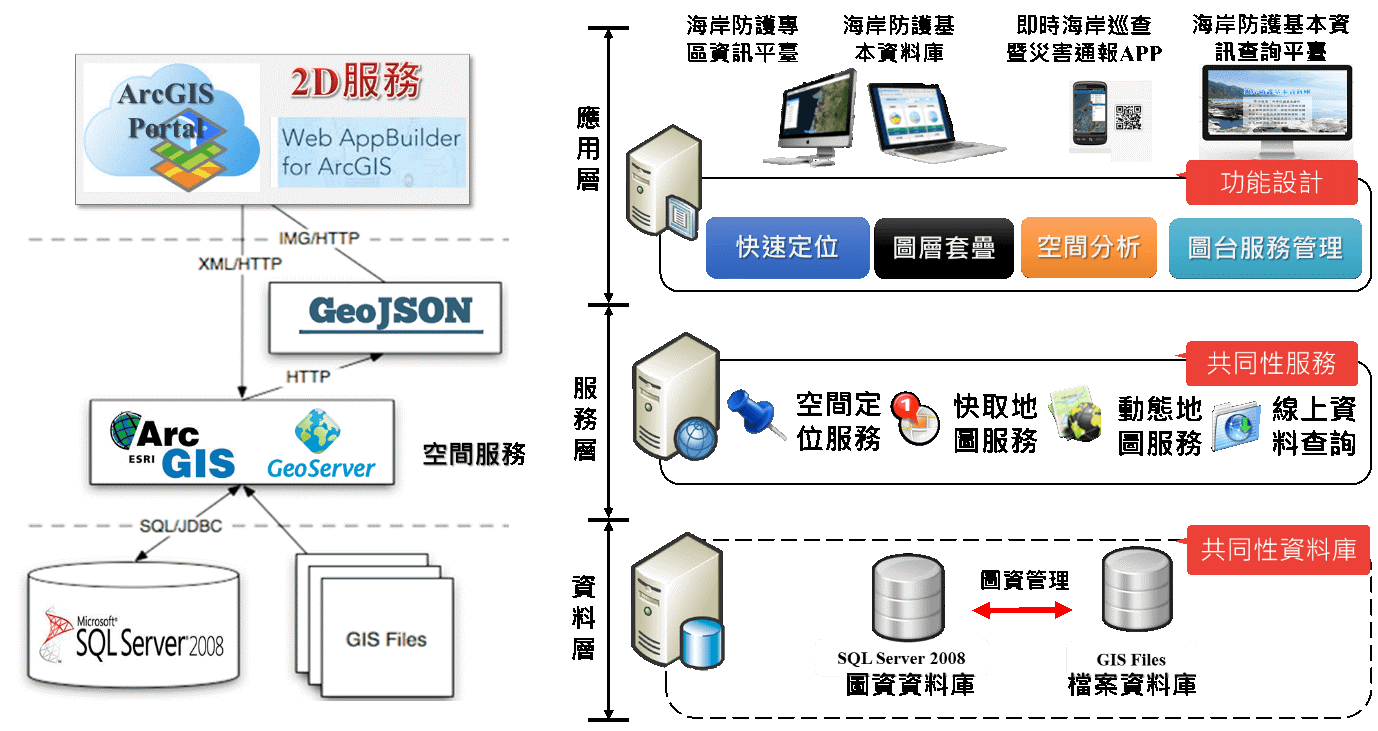
- Collecting coastal protection basic database continually, metadata establishing, Transformation standardize from dataset into database.(Fig.2)
- Web site development or modify system functions.
- System security maintenance.
- Background Management System.
- Promote the results of database systems.
- Data quality assessments, contributions and feedback mechanisms enhancement.
- Aggregation standard system development interface and new systems infixing interfacing assistance.
- Enforce the functions of importing data integration technology and updating rate upgrade.
- Data quality checklist and validation mechanism discussions, data check flow standardized and strengthen.

Figure.2 Architecture of system