According to the "Regulations for Flood potential information", the Flood Inundation Map should be reviewed by the production agency every five years. Since 1999, the Flooding Inundation Map has been completely updated twice. The third-generation Flood Inundation Map was based on the contents of the "Flood Inundation Map Production Manual" revised by the WRPI in 2013. There are 19 counties and cities' Flood Inundation Map have gradually completed from 2014 to 2016. The quality of the production results of the Flood Inundation Map has been improved year by year, and it is more accurate with the current situation.
After the completion of the Flood Inundation Map, it has been publicized by the MOEA in 2018, including the publicly Flood Inundation Map for simulating the potential for flooding and the extent of impact under different precipitation conditions, with a continuous rainfall of 150 hours. The Flood Inundation Map considers the depth of flooding and the range of impact area under different rainfall conditions. According to the requirements of disaster prevention applications, rainfall conditions including 150mm, 250mm, 350mm in 6 hours and 200mm, 300mm, 400mm in 12 hours and 200mm. , 350 mm, 500 mm, 600 mm in 24 hours. There are ten quantitative rainfall scenarios. For example, if the rainfall is 500 mm in Yunlin County, the Flood Inundation Map is shown in Figure 1.
The relevant public information can be found on the website of the Disaster Prevention Center of WRPI
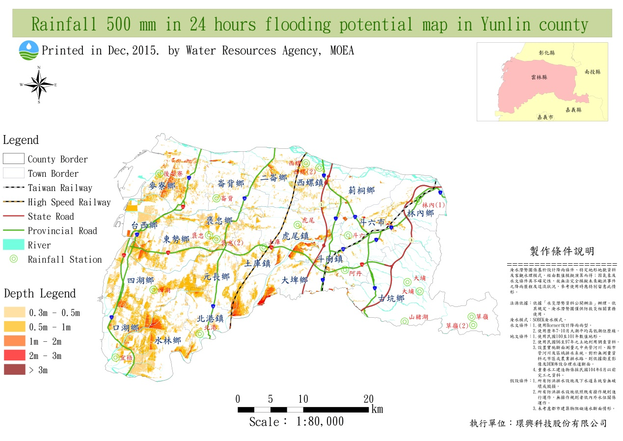
Figure.1 Rainfall 500 mm in 24 hours Flood Inundation Map in Yunlin county